- Security
- A
GEOINT Challenge: geolocation of street art in Dominica
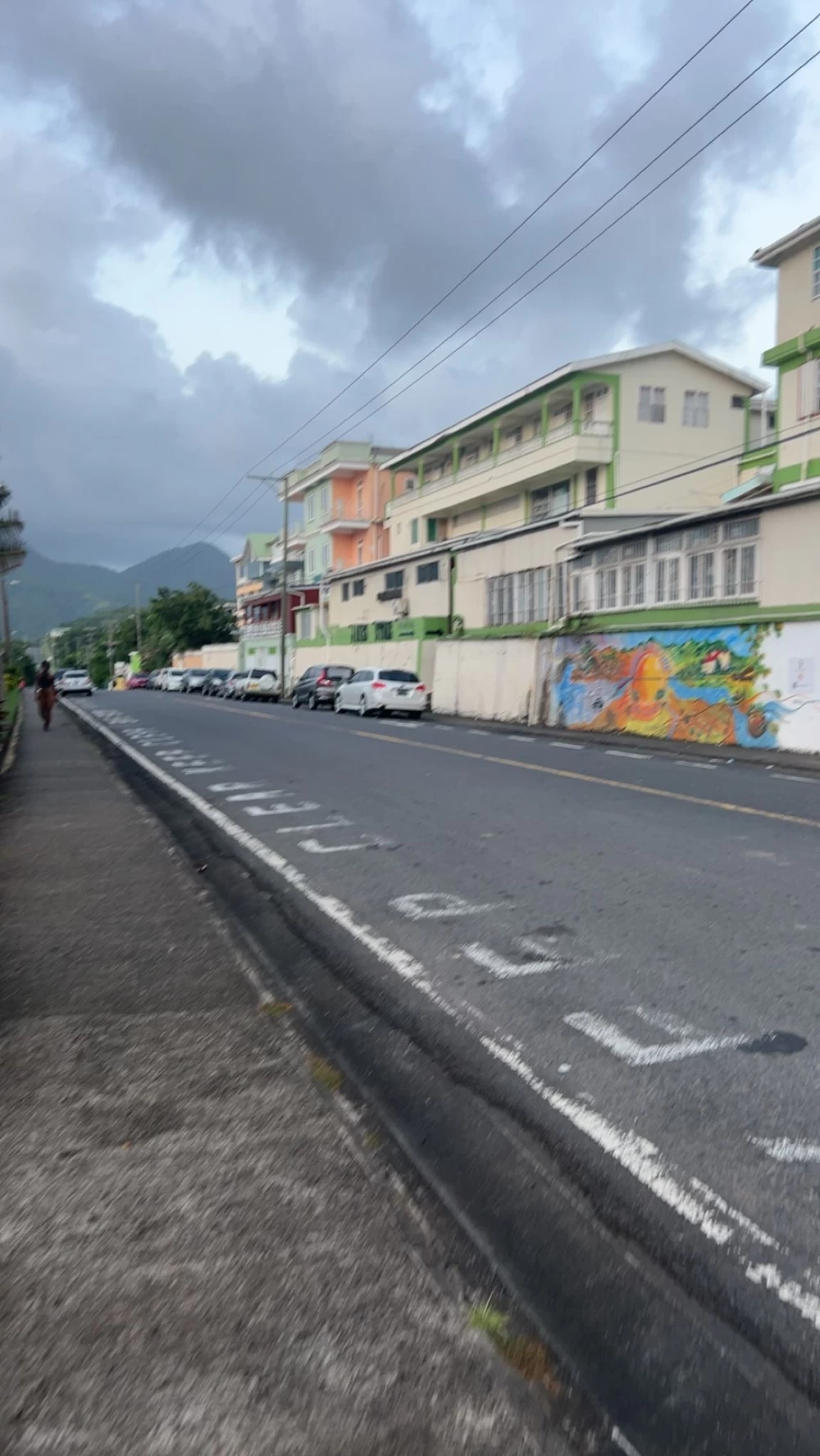
In September, UnShelledSec posted an interesting post on X, the goal of which was to find the exact location based on just one picture, a task that is not easy, but Ron Kaminsky managed and moreover, showed the algorithm of actions for solving it.
So, on September 2, a photo was posted on the X(Twitter) profile by UnShelledSec, an open-source intelligence analyst and co-founder of HACKTORIA, Ron Kaminsky participated in this GEOINT challenge and in this article you will understand how to uncover the exact location from the photo.
First, he carefully analyzed the image to gather a general impression of the background and objects. His primary goal was to identify any clues that would lead him to determine the exact location of the photo.
The red mark shows street art, which we will focus on. In addition, we can see a road (highway) marked with a pink mark. In the distance, you can see high mountains (marked with a green mark), and palm trees grow along the road, which suggests a tropical location.
Some also noticed the variety of license plates on cars, which can also give a clue about the geographical location. In addition, there is a road sign with the inscription "KEEP CLEAR" in English, which indicates that this is an officially English-speaking country.
At this stage, the author of the investigation used a tool called — GeoHint
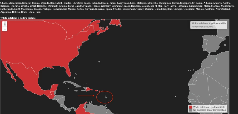
Accordingly, the yellow stripe in the center of the road is common in some European countries, but it is especially common in North America and nearby islands.
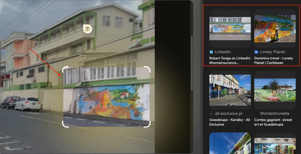
First, the author used the Google Lens tool, which can be considered a must-have for every geointer, as it is great for situations like this when, for example, you need to identify "our" street art.
However, with image search using this tool, there is one peculiarity, it gives several unrelated or similar places. For example, in the case of the author, it showed places such as: Puerto Rico and Mauritius.
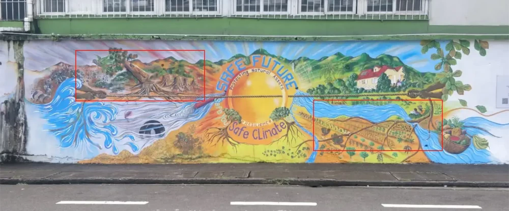
To improve the search, it is recommended to experiment with different objects in the image to get the most relevant results - so, the author focused on graffiti to find the same pattern and drawing.
Thus, two matches were found on the same wall with windows at the top.
Unfortunately, the first link did not give the desired result and led to a completely different post:
An interesting feature of graffiti is certain details, they can give us a clue about the location. In the image above, you can see mountains, a river, and many trees with roots, creating a tropical atmosphere.
When searching on Google, the author used various phrases such as: “river” AND “roots” AND “tropical” and came across a post on Pinterest with such a clue.
Apparently, this is Dominica with hashtags «Indian River» and «Portsmouth»
But, we will return to the second result, there is also a clue - «Dominica Travel - Lonely Planet | Caribbean»
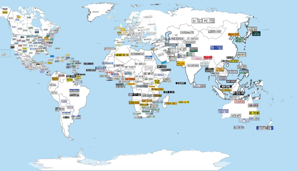
The author focused on this particular place and decided to double-check his hypothesis by comparing the license plates on the cars seen earlier in the photo using the site: - http://www.worldlicenseplates.com/
World License Plates - is a comprehensive online database showcasing vehicle registration plates from around the world. It contains images and detailed information about:
- License plate design: Examples of license plates from different countries and regions.
- Format and traffic rules: Information about the sizes, colors, and formats of license plates.
- Historical changes: Detailed information on how the design and rules for license plates have changed.
- Regional differences: Information about differences in license plate designs within the country.
And as expected, the hypothesis was confirmed and the geographical location does indeed correspond to the license plates.
In addition, there is also a useful map from the GeoGuessr community on Reddit
The author entered both places from the Pinterest post into Google Maps to pinpoint the area to focus on and found that "Indian River" and "Portsmouth" are only 1.7 km apart, which is great news - less area to research.
On this island, which is only 751 sq. km in size, there can't be many long roads considering the bends and mountains, so the author decided to focus on finding the main roads and highways on the island, and found a road network map from 2018:
According to the map, the red lines indicate main roads. We see many winding roads that surround the island and pass through the mountains, as shown on the map.
But our focus remains on the Indian River and Portsmouth area.
Here! Two straight main roads (in the green circle) have been found on the entire island, and they are very close to the places we are investigating.
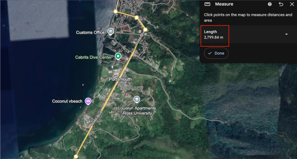
Now we have two main roads, but judging by the picture above, we need to exclude one side as it does not match the markers on the original image, the very mountains that were highlighted in yellow, so we focus on the road passing through Portsmouth.
The road is called "Ross Blvd" and it is about 3 km long.
The author took about 10 minutes to study the images and find the exact location. It matches the road layout and the "KEEP CLEAR" sign. There is a blank wall next to the building (of a different color) than in the original image - since the Google image is outdated, the graffiti is not yet visible.
He also noticed one of the features of the graffiti, namely the presence of QR codes intended as a historical summary of specific areas in Dominica, finding a local site that features various places of this kind.
He entered the following query into Google:
"QR" AND "dominica" AND "graffiti"Here is another view of the place he found, with the surrounding high mountains in the background.
Exact geolocation of the image: HG4R+HQ4, Ross Blvd, Portsmouth, Dominica. 15.563302,-61.454115
Before opening Google Mapsconsent.google.com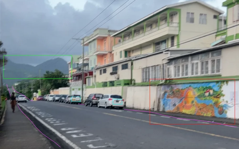













Write comment